About Myanmar
Following is a selection of general information about Myanmar and the
important tourist destinations. You will find more information under “Frequently
Asked Questions” . If you are interested in visiting restricted
areas (means areas where a travel permit needs to be arranged in
advance), please contact us. We can
advise you of possibilities, as most of those destinations are not
mentioned in detail on our web page.
THE COUNTRY
Myanmar was known until 1988 as Burma, the name the British gave the
country during colonial times. The country has been putting itself
into self-isolation between 1962 till around 1990 and therefore been
inaccessible to foreigners. This resulted in reduced development and
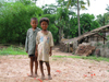
little contact with other lifestyles. People still live traditionally
and especially in the countryside retain their conservative ways of life.
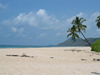
Myanmar offers unspoiled nature, magnificent archaeological sites,
stunning pagodas and temples, as well as warm and hospitable people .
The country is divided by 2 mountain ranges ranging from north to
south. From the west coast with a very wet tropical climate and
vegetation to the dry middle part with desert like vegetation and the
Eastern part of the country with Mediterranean vegetation and climate,
the country offers an abundance in plants and animals.
There are large forested areas with many different hard woods like
teak. You may
visit to some of the forests and jungles.
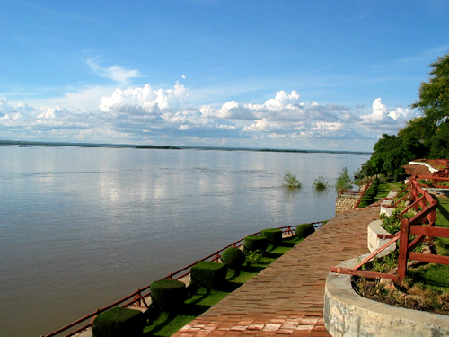
 Several mighty rivers originate from the mountains in the north,
flowing into the Andaman Sea in the south. The most famous one is the
Ayeyarwady (Irrawaddy) river. Other important rivers are the Thanlwin
(Salween) river, the Chindwin and the Sittoung (Sittang) River. Rivers
traditionally play a vital part in transportation. You can do river
cruises.
Myanmar also has the Mekong River as its borderline in parts of the
far east of the country.
Several mighty rivers originate from the mountains in the north,
flowing into the Andaman Sea in the south. The most famous one is the
Ayeyarwady (Irrawaddy) river. Other important rivers are the Thanlwin
(Salween) river, the Chindwin and the Sittoung (Sittang) River. Rivers
traditionally play a vital part in transportation. You can do river
cruises.
Myanmar also has the Mekong River as its borderline in parts of the
far east of the country.
Yangon is by far the largest town with nearly 6 million inhabitants and used to be the Capital of Myanmar. Mandalay is the second largest town. In November
2005, the government moved the whole administration 400 km north of
Yangon to the town Pyinmanar (Naypyidaw / Nay Pyi Taw).
Amongst
the other larger towns are Bago (Pegu), Pyay (Srikatsra), Mawlamyaing
(Moulmein), Taunggyi, Lashio, Tachileik, Kyaing Tong (Keng Tong), Myitkyina, Sittwe,
Pathein (Bassein), Myeik, Hpa-An and Kawthoung (bordering Thailand in
the far south).
Bhamo (Bamaw), if one travels from the border, Muse, if one travels
from central Myanmar, Putao and Tamu are amongst the towns that can be visited
with prior travel permit only.
Bhamo (Bamaw) can be reached from Mandalay without permit.
Myanmar consists of 7 States and 7 Divisions:
The states are populated mainly by tribal people; namely Rakhine (Arakan)
State, Chin State, Mon State, Kayah (Karenni) State, Shan State,
Kachin State and Kayin (Karen) State.
Whereas the Divisions are populated mainly by the majority Myanmar
(Burmese) people, namely Yangon Division, Bago Division, Magway
Division, Mandalay Division, Sagaing Division, Ayeyarwady Division and
Taninthayi (Thaninsarim - Tenasserim) Division.
Top
CLIMATE AND WEATHER
 Myanmar has three "seasons", namely:
-
“Winter” season from mid of October to end of
February with temperatures of 25-30 degrees Celsius in lower
lying parts of Myanmar and 8-22 degrees in the mountains, where
night temperatures might drop to 0 degrees Celsius. There is
almost no rain during these months.
-
Summer / Hot Season from March to May with temperatures up to 40
degrees Celsius. In the plains it can get even hotter.
-
Rainy Season from May / June to beginning of October with humid heat and
heavy monsoon rainfalls in the coastal regions. Average temperatures
range around 30 degrees Celsius. It is not that rainy and humid in the
central plains.
-
Cyclons sometimes happen towards the end of the hot season end
of April / May. Normally they move northwards to Bangladesh and
sometimes also hit the western coast in Myanmar.
Most tourists visit Myanmar during winter season, the rainy season
however is becoming more popular especially for visits to the central
plains.
HISTORY
The first settlers to Burma 2500 years ago were Mon ethnic groups,
followed by the Pyu, and later in the 10th century by the Burmese,
who still today present the majority of people.
The Mon had done trading with India and accepted Buddhism in the 3
century BC. In the era between 4th and 9th century AD, Pyu Kingdoms
like Vishnu, Hanlin and Sri Khatra were established along Ayeyarwady (Irrawaddy)
riverbanks.
In the 9th century, the Burman group migrated from the Northeast Yunnan
province of China to Burma. Along their migratory route, they settled
down in the region of Nancho (Yunnan) but were attacked by the giant
of that area. They arrived at last to the central plains of Burma and
chose the fertilized land like Kyaukse- and Minbu area, practicing
irrigated farming. The Burmans got conflicts with the Mon who were the
original settlers in these areas.
In 1049, the Burmese King Anawratha successfully established the first
Kingdom of Burma in Bagan and adopted the Theravada Buddhism from the
Mon. The Mongol Tartar group destroyed this Kingdom in 1287.
The Shan, another ethnic group, were also trying to establish their
Kingdom in the areas of Ava, Sagaing and Pinya but those did not last
long.
In the 15th century another Burmese King - Bayinaung organized the
small kingdoms in the whole area and established the second Kingdom
of Burma called Hansawady in Bago (Pegu) area. But it didn’t last
long as his successors were inefficient in maintaining the Kingdom
well.
Between 17th and 18th century, a village headman by the name of U Aung
Zaya (Alaungphaya) from Shwebo area established the third Burma Empire
by organizing the Mon of lower Burma, the Shan of Upper Burma and set
up the Kongbaung dynasty. But in those days, the colonialism and
annexation of Asian countries to Great Britain and other Europeans
already spread. As a consequence, Burma was completely colonized by
the British in 1886. Burma regained independence only in 1948.
The “divide and rule” system practiced by the British had intensified
conflicts between minority tribes and the majority Burmese. Civil war
ignited.
In 1962, the Socialist group had taken power, trying for the country
to be self-sufficient. In 1988, the military took responsibility from
the socialist government until now.
Top
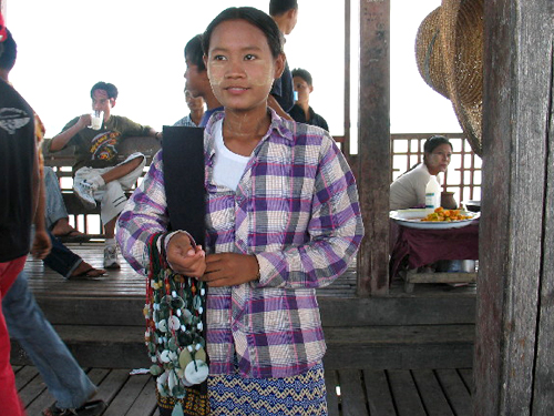
NATIONAL RACES & POPULATION
 The majority of
the 54 million population are ethnic Burmese. The majority of
the 54 million population are ethnic Burmese.
Minorities are the Shan, Kayin, Kachin, Rakhine, Mon and Chin. Amongst
those there are again numerous tribal groups.
Totally there are around 130 different ethnic groups recognized.
In addition there is a small Chinese and Indian population.
 Around 80% of the people in Myanmar believe in Buddhism. Often the
practices are mixed with worshiping the “Nats”, animistic spirits. Around 80% of the people in Myanmar believe in Buddhism. Often the
practices are mixed with worshiping the “Nats”, animistic spirits.
Others religions practiced are: Christianity, Islamic and to a lesser
extend Hinduism.
Two thirds of the whole population still earns their living on
farming.
FAUNA AND FLORA
Rare species like tigers, leopards and golden deers are still found in
hardly accessible parts of Myanmar. Visible to visitors are a variety
of birds, butterflies and many insects like crickets, buffaloes and
cattle.
If you are interested in exploring specific kinds of animals, please
ask us for possibilities; there are a number of sanctuaries for birds
and wildlife. Elephant camps also exist.
Many kinds of fishes and crabs are found in rivers and creeks.
If you have luck, you may see a river dolphin in the Ayeyarwady River
upstream of Mandalay.
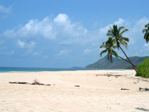
The Flora is varying from evergreen forests, deciduous (e.g. teak)
trees to conifers. As Myanmar is covered with wide natural forests,
there are many kinds of orchids and other plants in innumerous
species. In costal areas various palm trees and mangroves grow.
Any kind of fruits you imagine grow in Myanmar. Rice, wheat, beans
and maize is cultivated.
Top
GENERAL INFORMATION
The Myanmar calendar is based on the lunar cycle, many important
holidays are held during full-moon days. The year 2008 (from ca. 17.
April onwards) is the year
1370 in Myanmar calendar. The western Gregorian calendar is used as
well.
Myanmar uses the following measurements:
Miles (1.61 km), foot (30.48 cm) and inches (2.54 cm) for distances.
Gallons (4.55 liters) for liquids.
Viss (1.63 kgs) and Tical (16.3 gramm) for weights.
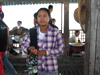
There are however numerous other ways to measure different items if you
go to the market. The metric system is not used widely.
Myanmar as a developing country has a comparably high literacy rate of
around 91%. English is spoken only in large cities, especially amongst
elder people. The official language Myanmar (Burmese) is widely
understood and used all over the country. Most ethnic groups in
addition speak their own local dialects and languages.
The standard of hygiene in many parts of Myanmar is quite poor.
People from outside of Myanmar don’t know that Myanmar is an
exceptionally safe country to travel. Theft and capital crime is
negligible, although slightly rising.
Since end of 2004 a number of bomb explosions occurred, causing also
casualties, however not aimed specifically at foreigners. In May 2005
there were 3 simultaneous bomb explosions in Yangon, which caused
several casualties.
There was unrest especially happening in the bigger towns of Myanmar
during the year 2007 September due to the fuel price hike up which
was put down by the authorities. Since then the situation went
back to normal again.
Standard time in Myanmar is 6.5 hours ahead of GMT
Electricity supply in theory is 220V, 50 Hz. The supply can be erratic and
fluctuating, especially outside of major cities.
Top
PLACES TO VISIT IN MYANMAR
The standard route, most first time travelers would take, comprises of
Yangon, Mandalay, Bagan and Inle Lake. Those are classical sites with
the best infrastructure.
In the following table you will find all important sites at one
glance. For detailed explanations on particular sites, please click on
the item and the details will automatically be shown in the list.
Places to Visit in
Myanmar
|
|
For places further away, please find more information under
eco-tourism or
write us
Top |